Dog walks in Lloyd District, Portland
The parks, off-leash dog areas, and trails within about a 15-minute walk of central Lloyd District.
Within about a 15-minute walk of central Lloyd District, you'll find 7 parks covering about 51 acres and 2.5 miles of named walking paths.
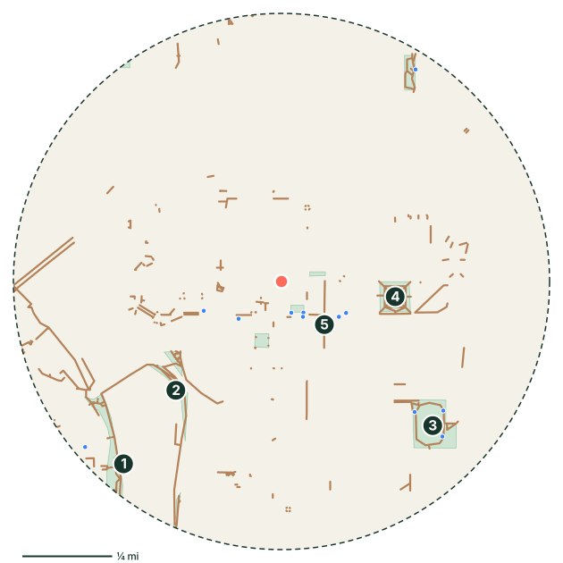
Parks near Lloyd District
- Governor Tom McCall Waterfront Park
- Vera Katz Eastbank Esplanade
- Buckman Field
- Holladay Park
- Oregon Square Courtyard
- Oregon Convention Center Plaza
- Lillis-Albina Park
Off-leash dog areas near Lloyd District
There are no mapped off-leash areas within about a 15-minute walk. The closest neighborhoods with dog areas are Old Town, Eliot and Pearl District.
Off-leash hours and rules vary by park. Always check the posted signs before letting your dog off leash.
Walking paths and trails
- Willamette Greenway Trail
- Vera Katz Eastbank Esplanade
- Broadway Bridge
- Northeast Lloyd Boulevard
- Steel Bridge (Lower Deck)
Good to know
- 13 mapped drinking fountains nearby. Still bring water on warm days.
- Portland is mild but wet for much of the year, so expect muddy paws from fall to spring. Portland Parks has designated off-leash areas. Elsewhere, dogs must be leashed.
- Planning the day's walk? See how long to walk your dog.
Lloyd District dog walk FAQ
Where can I walk my dog in Lloyd District?
Is there a dog park near Lloyd District?
Park, trail, and amenity data © OpenStreetMap contributors (ODbL), as of September 18, 2026. Distances are straight-line from the neighborhood's center point, so actual walking routes are a little longer. Parks marked as closed to dogs in OpenStreetMap are left out, but rules change, so follow posted signs.