Dog walks in Duboce Triangle, San Francisco
The parks, off-leash dog areas, and trails within about a 15-minute walk of central Duboce Triangle.
Within about a 15-minute walk of central Duboce Triangle, you'll find 18 parks covering about 117 acres and 6 off-leash dog areas.
18Parks nearby
117Acres of parks
6Off-leash areas
0.3Trail miles
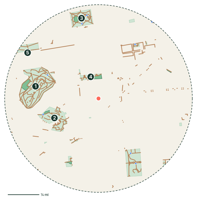
Parks near Duboce Triangle
- Buena Vista Park
- Corona Heights Park
- Alamo Square
- Duboce Park
- Panhandle
- Mission Dolores Park
- Eureka Valley Recreation Center
- Mission Playground
Off-leash dog areas near Duboce Triangle
- Dog Play Area at Duboce Park
- Corona Heights Dog Play Area
- Eureka Valley Recreation Center dog area
- Buena Vista Dog Run
- SoMa West Dog Park
- Alamo Square dog area
Off-leash hours and rules vary by park. Always check the posted signs before letting your dog off leash.
Walking paths and trails
- Oak Street Cyclepath
Good to know
- 11 mapped drinking fountains nearby, 5 with a dog bowl or dog-level spout. Still bring water on warm days.
- 2 mapped dog waste stations along the way.
- San Francisco is mild year-round, often foggy and cool, so long walks work in almost any season. The city has dozens of designated dog play areas. Outside them, leash rules apply, and some sensitive habitat areas restrict dogs entirely.
- Planning the day's walk? See how long to walk your dog.
Duboce Triangle dog walk FAQ
Where can I walk my dog in Duboce Triangle?
The main green spaces within about a 15-minute walk of central Duboce Triangle are Buena Vista Park (38 acres), Corona Heights Park (15 acres) and Alamo Square (13 acres). For a longer walk, try the Oak Street Cyclepath. Most city parks require dogs to be leashed outside designated off-leash areas.
Is there a dog park near Duboce Triangle?
Yes. Dog Play Area at Duboce Park is about 0.2 miles from the neighborhood center, and 5 more off-leash areas are within a 15-minute walk. Check posted hours and rules before you go.
Park, trail, and amenity data © OpenStreetMap contributors (ODbL), as of September 18, 2026. Distances are straight-line from the neighborhood's center point, so actual walking routes are a little longer. Parks marked as closed to dogs in OpenStreetMap are left out, but rules change, so follow posted signs.