Dog walks in Central District, Seattle
The parks, off-leash dog areas, and trails within about a 15-minute walk of central Central District.
Within about a 15-minute walk of central Central District, you'll find 25 parks covering about 65 acres, 1 off-leash dog area, and 1.3 miles of named walking paths.
25Parks nearby
65Acres of parks
1Off-leash areas
1.3Trail miles
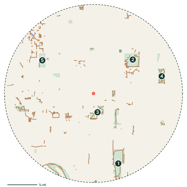
Parks near Central District
- Judkins Park and Playfield
- Garfield Playfield
- Pratt Park
- Powell Barnett Park
- Seattle University Park
- Dr. Blanche Lavizzo Park
- Lewis Park
- Judge Charles M. Stokes Overlook
Off-leash dog areas near Central District
- Construction Site Dog Park
Off-leash hours and rules vary by park. Always check the posted signs before letting your dog off leash.
Walking paths and trails
- Central Park Trail
- I 90 Trail
- Yesler Hillclimb
- Lewis Park Trail
- Mountains-to-Sound Trail
- South Lane Street
Good to know
- 2 mapped drinking fountains nearby. Still bring water on warm days.
- 3 mapped dog waste stations along the way.
- Seattle’s mild, damp weather makes year-round walking easy, but expect muddy paws from fall through spring. Seattle Parks has designated off-leash areas. Elsewhere, dogs must stay leashed.
- Planning the day's walk? See how long to walk your dog.
Central District dog walk FAQ
Where can I walk my dog in Central District?
The main green spaces within about a 15-minute walk of central Central District are Judkins Park and Playfield (18 acres), Garfield Playfield (7.3 acres) and Pratt Park (4 acres). For a longer walk, try the Central Park Trail. Most city parks require dogs to be leashed outside designated off-leash areas.
Is there a dog park near Central District?
Yes. Construction Site Dog Park is about 0.4 miles from the neighborhood center. Check posted hours and rules before you go.
Park, trail, and amenity data © OpenStreetMap contributors (ODbL), as of September 18, 2026. Distances are straight-line from the neighborhood's center point, so actual walking routes are a little longer. Parks marked as closed to dogs in OpenStreetMap are left out, but rules change, so follow posted signs.