Dog walks in Fauntleroy, Seattle
The parks, off-leash dog areas, and trails within about a 15-minute walk of central Fauntleroy.
Within about a 15-minute walk of central Fauntleroy, you'll find 8 parks covering about 158 acres and 1.5 miles of named walking paths.
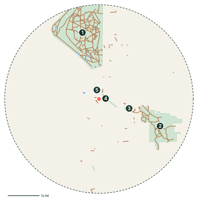
Parks near Fauntleroy
- Lincoln Park
- Fauntleroy Park
- Kilbourne Park
- Fauntleroy Creek Ravine
- Cove Park
- Captain's Park
- Katharine Colman Triangle
- Endolyne Park
Off-leash dog areas near Fauntleroy
There are no mapped off-leash areas within about a 15-minute walk. The closest neighborhoods with dog areas are Youngstown, Van Asselt and Rainier Valley.
Off-leash hours and rules vary by park. Always check the posted signs before letting your dog off leash.
Walking paths and trails
- Trail #2
- Trail #1
- Trail #8
- Trail #11
- Trail #9
- Trail #13
Good to know
- 6 mapped drinking fountains nearby. Still bring water on warm days.
- Seattle’s mild, damp weather makes year-round walking easy, but expect muddy paws from fall through spring. Seattle Parks has designated off-leash areas. Elsewhere, dogs must stay leashed.
- Planning the day's walk? See how long to walk your dog.
Fauntleroy dog walk FAQ
Where can I walk my dog in Fauntleroy?
Is there a dog park near Fauntleroy?
Park, trail, and amenity data © OpenStreetMap contributors (ODbL), as of September 18, 2026. Distances are straight-line from the neighborhood's center point, so actual walking routes are a little longer. Parks marked as closed to dogs in OpenStreetMap are left out, but rules change, so follow posted signs.