Skip to guide

Minnesota · 7 walks to try

Dog walks in
Minneapolis

Lake loops, riverfront detours, and a little more room to sniff.

Find a walk
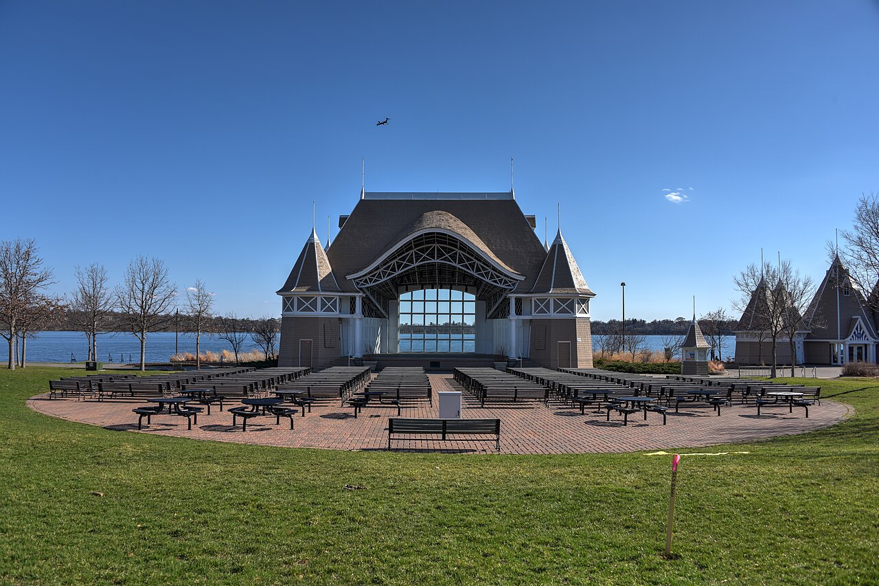
The Lake Harriet bandshell with park benches and a lakeside path
Lake Harriet bandshell
Photo credit

August Schwerdfeger, 2016 · CC BY 4.0. Resized; cropped to fit.

Short dog walks in Minneapolis

Choose an outing you can shorten, or compare a smaller published circuit. A park’s whole trail network is not the distance you have to walk.

  • Boom Island & Nicollet Island

    Choose your distance. Stay on Boom Island’s open paths and turn back before adding the island connections. This gives you a flexible visit without committing to a full lake loop.

    Park walking paths and a pedestrian bridge. Start: 724 Sibley Street NE. Directions, access notes and official sources.

  • Wirth Lake

    1.35 mi loop. This is the shortest published lake circuit in this guide. Compare the full distance with your available time; you can choose an out-and-back instead. Stay outside Eloise Butler Wildflower Garden, where pets are excluded.

    Lake-area park paths. Start: 3200 Glenwood Avenue. Directions, access notes and official sources.

For context, our Dog Walking Report found a median of 26 minutes and 0.8 miles across 341 recorded walks from 110 owner accounts. This is a community-wide sample, not a Minneapolis or Minnesota estimate, and it is not an exercise target.

If a full circuit is more than you want today, choose a turnaround on an open path and allow for the return. Use the dog walk calculator for a starting plan and record the actual outing with your phone.

A little help choosing

What kind of walk today?

Pick a spot for directions and the useful details.

7 walks

Lake loop

Lake Harriet

A classic lake lap, with the bandshell as your start and finish.

Distance
2.75 mi loop
Surface
Paved lakeside path
Dogs
Keep leashed

Follow the pedestrian path around the lake. Want a shorter walk? Head along the shore and turn back when you’re ready.

Start here

4135 W Lake Harriet Parkway

Get directions
Heads up

Follow signed winter routes and check park notices for shoreline or pavilion work.

Parking, distance notes & sources

Paid parking, restrooms and drinking water are listed. Facilities are seasonal, so check before relying on them.

Published pedestrian circuit; extra side trips add distance.

Lake loop

Bde Maka Ska

Pick this one when you and your dog want a longer lake lap.

Distance
3.1 mi loop
Surface
Paved lakeside path
Dogs
Keep leashed

Join the signed pedestrian path and follow it around the lake. The full walking circuit is 3.1 miles.

Start here

3000 Bde Maka Ska Parkway

Get directions
Heads up

Shoreline work was scheduled to start in fall 2026. Check the project page and follow any posted detours.

Parking, distance notes & sources

Paid parking and restrooms are listed. Use the park map to pick an entrance; facilities vary by season.

Walking circuit, not the 3.19-mile bicycle circuit.

Lake loop

Lake of the Isles

A lake loop that’s a little shorter than Harriet or Nokomis.

Distance
2.63 mi loop
Surface
Lakeside pedestrian path
Dogs
Keep leashed

Join the pedestrian path at the lakeshore and follow the circuit back to your entrance. Watch the signs where walking and cycling paths meet.

Start here

2500 Lake of the Isles Parkway E

Get directions
Heads up

Keep your dog leashed on the lake path. The separate off-leash park has its own boundaries and permit rules.

Parking, distance notes & sources

The park address puts you on the east shore. Choose a parking spot using the map and local street signs.

Published pedestrian circuit; the bike circuit is longer.

Lake loop

Lake Nokomis

A south Minneapolis lake lap, close in length to Lake Harriet.

Distance
2.7 mi loop
Surface
Lakeside walking path
Dogs
Keep leashed

Start near the main beach parking area and follow the lakeside walking path. Keep your dog on permitted park paths around the beach.

Start here

5001 Lake Nokomis Parkway W

Get directions
Heads up

Check shoreline and beach project updates before you go. Water fountains and restrooms may close for the season.

Parking, distance notes & sources

The main beach has paid parking and restrooms. Check seasonal opening times for facilities.

MPRB’s published pedestrian circuit; entrance detours vary.

Riverfront

Boom Island & Nicollet Island

Riverside paths for a walk you can make as short or long as you like.

Distance
Choose your distance
Surface
Park walking paths and a pedestrian bridge
Dogs
Keep leashed

Start on Boom Island’s paths. Keep going toward B.F. Nelson Park and the Nicollet Island bridge if open, or turn back within the park.

Start here

724 Sibley Street NE

Get directions
Heads up

Check signs at bridge connections. This is a set of connected paths, so choose your own turnaround.

Parking, distance notes & sources

Paid parking and a restroom are listed. The parking lot closes at 9 pm.

Connected paths, not one verified fixed-length loop.

Lake loop

Wirth Lake

The shortest published lake circuit in this guide. Handy when you want a smaller lap.

Distance
1.35 mi loop
Surface
Lake-area park paths
Dogs
Keep leashed

Use the lake-area park map to join the open circuit. Stay on designated walking paths, especially near bike and groomed ski trails.

Start here

3200 Glenwood Avenue

Get directions
Heads up

Leave the dog walk outside Eloise Butler Wildflower Garden. Pets are excluded; on-duty service animals are allowed.

Parking, distance notes & sources

The beach page lists free parking at 3200 Glenwood Avenue. Seasonal beach facilities may be closed.

MPRB’s Wirth Lake trail distance, not the whole regional park.

Creek trail

Minnehaha Regional Park

Come for the falls, then choose how much walking you feel like doing.

Distance
Choose your distance
Surface
Developed paths; lower routes vary
Dogs
Keep leashed

Start on an open path around the developed falls area. Check access and terrain before adding a lower trail; return the way you came for a shorter walk.

Start here

4801 S Minnehaha Drive

Get directions
Heads up

Off-leash use is scheduled to end December 21, 2026. Leashed walks are to continue; check the park’s latest update.

Parking, distance notes & sources

Use the regional park address here. The off-leash area has a separate entrance farther south.

Upper park paths and lower trails are different outings.

A few local tips

Bring a leash

Keep your dog leashed on paths. Designated off-leash parks have their own boundaries and need an MPRB permit.

MPRB off-leash rules and permits

Winter paths switch

In winter, MPRB plows and sands bike paths for shared use. Follow seasonal signs and check the snow-event map.

MPRB trail rules and winter paths

Good to know

Which Minneapolis dog walk is shortest on this list?

MPRB lists the Wirth Lake circuit at 1.35 miles. The other lake walks here range from 2.63 miles at Lake of the Isles to 3.1 miles at Bde Maka Ska. You can also make an out-and-back visit shorter by turning around along the same open path.

MPRB pedestrian trail distances
Can my dog go into Eloise Butler Wildflower Garden?

Pets are excluded from the garden; on-duty service animals are allowed. Leashed dogs are allowed in the greater Theodore Wirth Regional Park, so plan your walk outside the garden boundary.
Eloise Butler visitor and pet information

About this guide

Researched from official park information, checked October 19, 2026. We haven’t field-tested every walk. Use park notices for current conditions.

About the distances & research

Loop distances and trail-network totals are labeled separately. Directions lead to a starting point, not a recorded walking route.

Send a correction or local tip